

Main content starts here.
Overview
Last updated date:2024/1/23
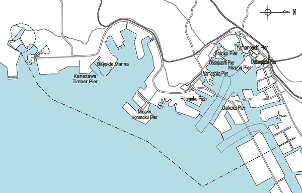
| Honmoku Pier | Yamashita Pier | Osanbashi Pier | Shinko Pier | Yamanouchi Pier Detamachi Pier |
| Bayside Marina | Daikoku Pier | Kanazawa Timber Pier | Minami Honmoku Pier | Mizuho Pier |
INTRODUCTION
The Port of Yokohama is located on the northwestern edge of Tokyo Bay. It is a naturally blessed port with a spacious water area on the eastern side and undulated hills on the northern, western and southern sides. In addition to its natural assets, the port has been equipped with various facilities, such as inner and outer breakwaters, that protects the port from the effects of winds and tides. It also has an ample water depth.
◎Location
North Latitude: Lat. 35.19.-29.N East Longitude: Long. 139.37.-45.E
◎AREA (As of March 2023)
Port Area - 7,218.3ha
Waterfront Area - 2,936.8ha
Commercial Zone - 1,064.7ha
Industrial Zone - 1,712.1ha
Marina zone - 4.2ha
Scenic and Recreational Zone - 87.7ha
Others - 68.1ha
◎HISTORY OF THE PORT
Opening of the port: June 2, 1859
The Port of Yokohama has a long-standing history as a leading international trade port in Japan.
For a detailed timeline, please go to History of the Port of Yokohama.
◎PORT ACTIVITIES (2022)
Number of incoming vessels: 30,345
Volume of Cargo Handling: 106.22 million tons
Number of Containers: 2.98 million TEUs
For more port statistics, please visit the Statistics Page
.
Page ID:645-961-916